- Phone:0571-86826618
- Email:business@bwton.com
- Address:13th Floor, Building B1, Dingchuang Fortune Center, Future Science and Technology City, Yuhang District, Hangzhou, Zhejiang, China


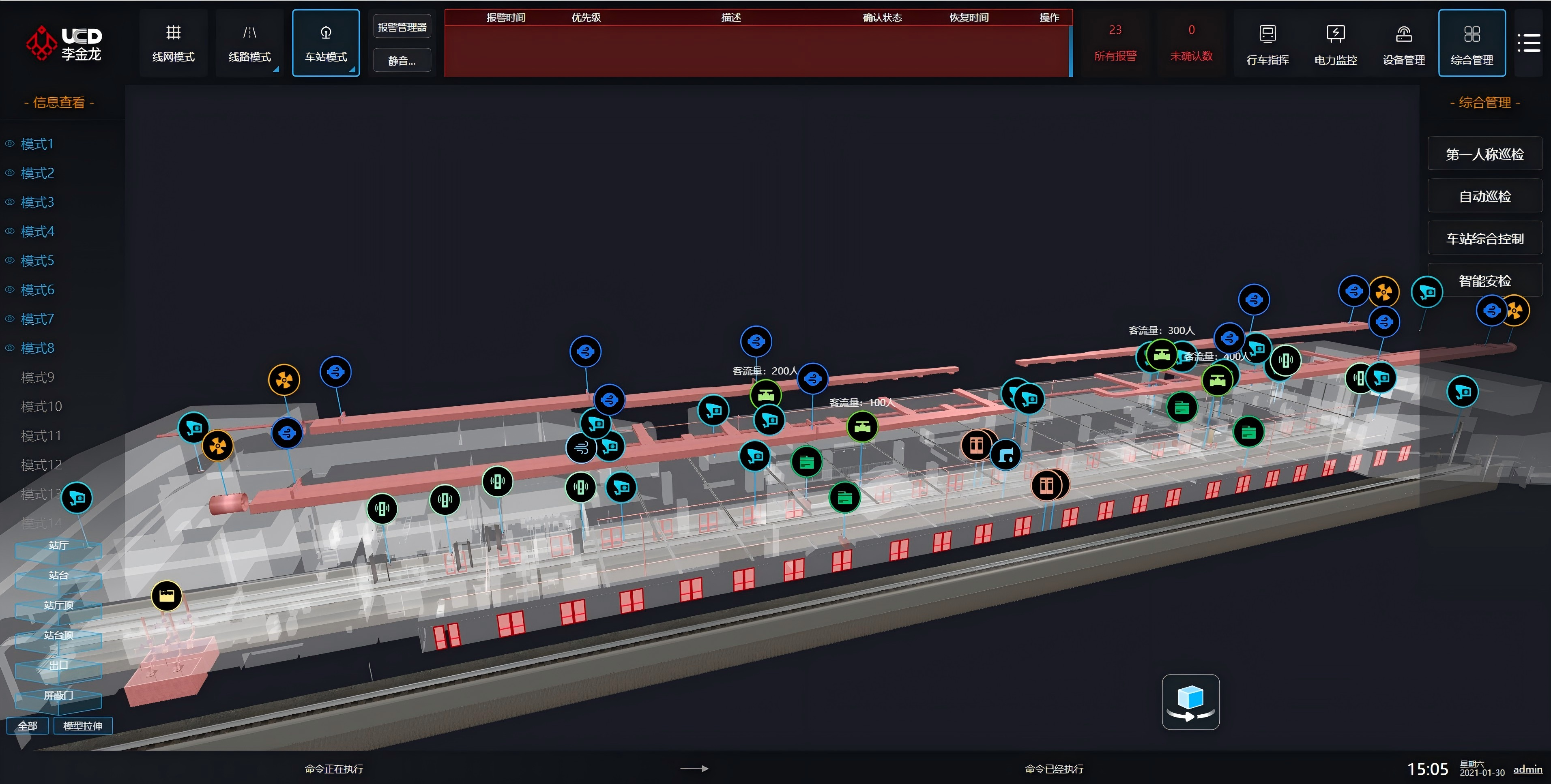
Based on spatial deduction, it realizes dynamic emergency plans for integrated fire prevention and rescue, panoramic management of fire facilities and auxiliary decision-making for emergency command, upgrading fire management from 2D paper drawings to 3D real-scene deduction.
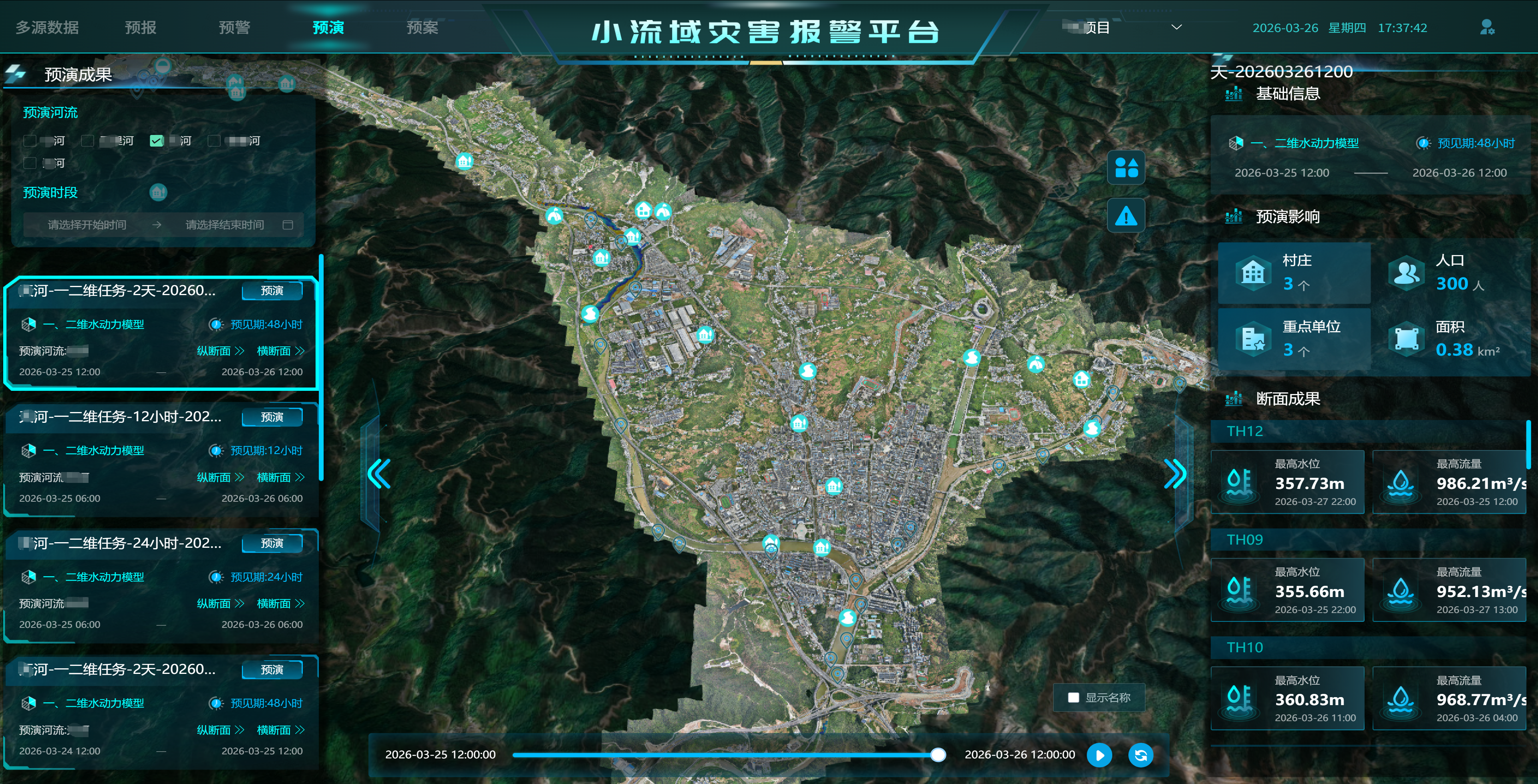
Enable physical-level flood simulation deduction and automatic inspection to realize early detection, early warning and early disposal of hidden dangers in water conservancy facilities.
Empower full-lifecycle maintenance and digital overload control of expressways, realizing data-based operation of road assets and intelligent scheduling of maintenance work.
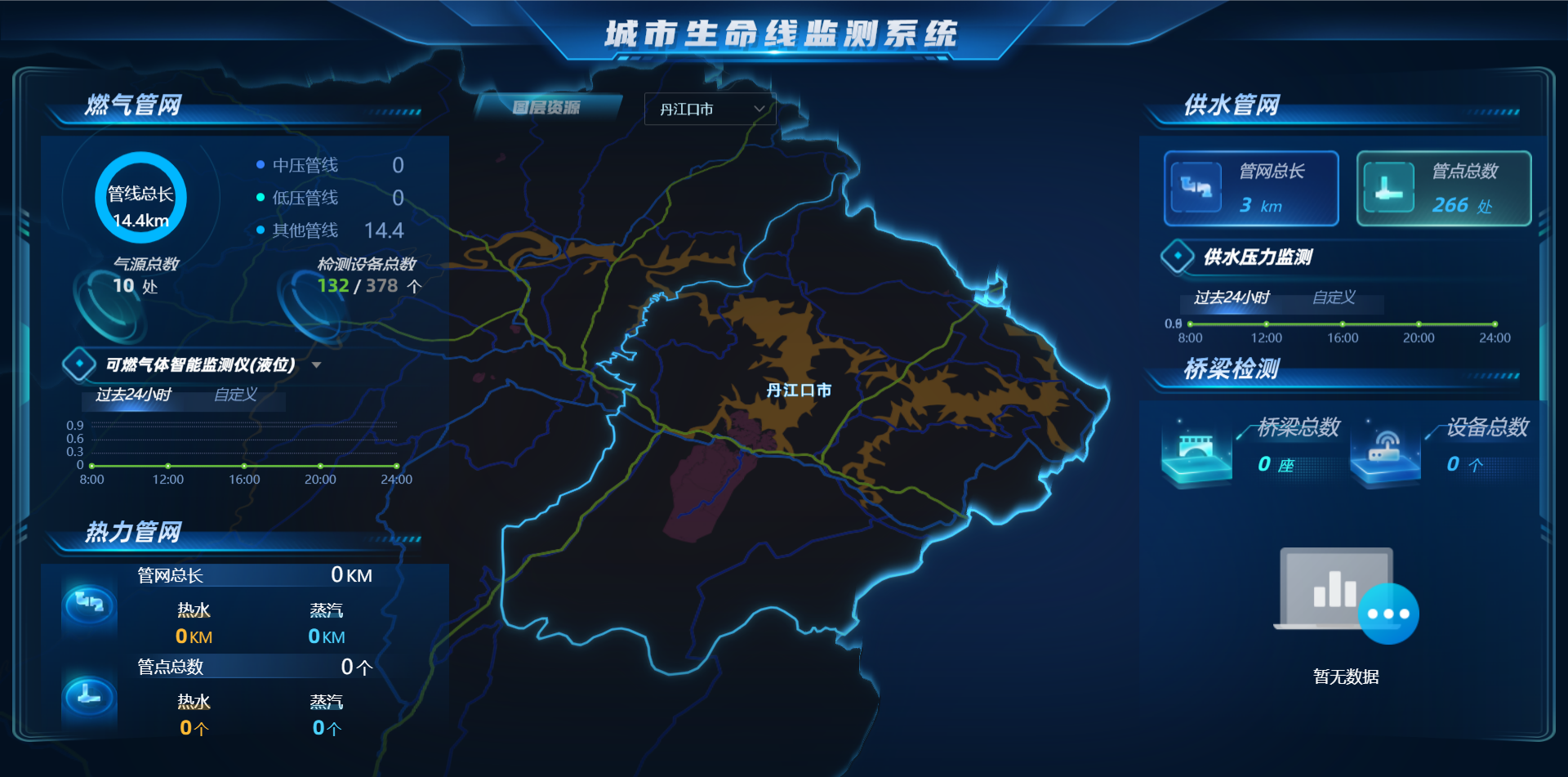
Round-the-clock online monitoring of concealed projects such as water supply, gas supply and drainage, with real-time risk early warning to ensure safe urban operation.
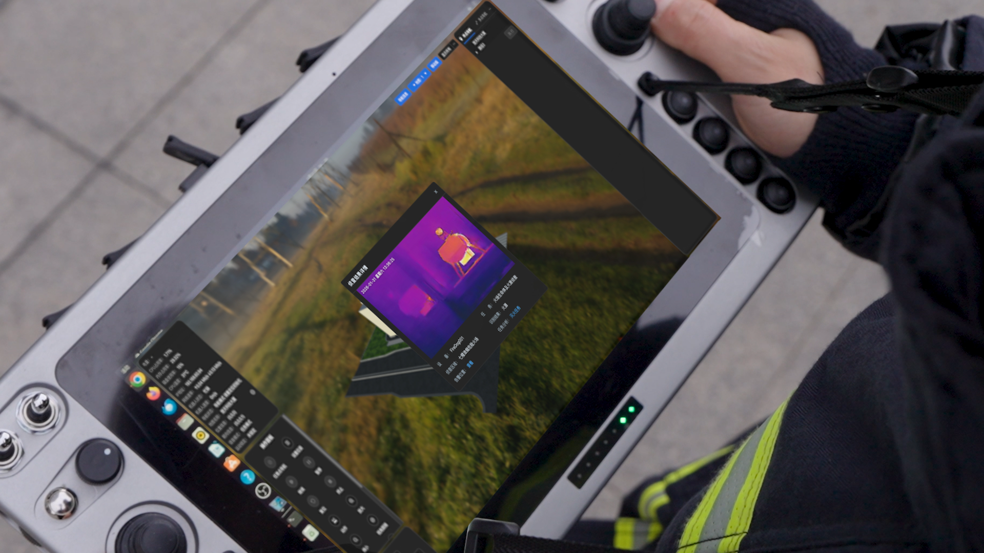
u360 adopts 360° panoramic image acquisition to realize image processing, SLAM-based trajectory mapping and device spatial mapping. It revolutionizes traditional inspection modes and shifts retrieval from time/event-based to space-based. The platform addresses difficulties in information traceability and disconnection between work procedures during fire inspections, boosting the accuracy and timeliness of supervision. It also fixes the lag in 3D model updates for management teams, and elevates the digitalization, intelligence and efficiency of fire safety management.
This tool delivers full-fledged spatial modeling capabilities. uBuilder supports one-click model conversion from CAD files, reverse modeling via point clouds and rapid parametric modeling. It has completed refined indoor modeling covering over 300 million square meters nationwide, with its lightweight model size merely one-tenth of traditional BIM models. Embedded with industry-specific component libraries for fire protection, water conservancy, power and other sectors, it has been widely deployed across diverse scenarios and accumulated massive real-world data, laying a solid foundation for the training and accuracy optimization of multimodal large models.
It deeply integrates geometric, topological, attribute and IoT data, and features 20 proprietary semantic dimension analysis capabilities. The platform endows every building and room with an AI-readable "digital identity", and provides a robust spatial data foundation for upper-level intelligent applications via open APIs.
Unified fusion and intelligent visualization of multi-source geospatial data. Visual process orchestration allows business users to configure data animations by drag-and-drop without coding. Deeply adapted to industry scenarios: supports climbing surface marking and fire lane planning in fire protection; provides geographic base for digital twin river basins in water conservancy; enables full-lifecycle asset management for expressways in transportation.
 浙公网安备33010802008444号